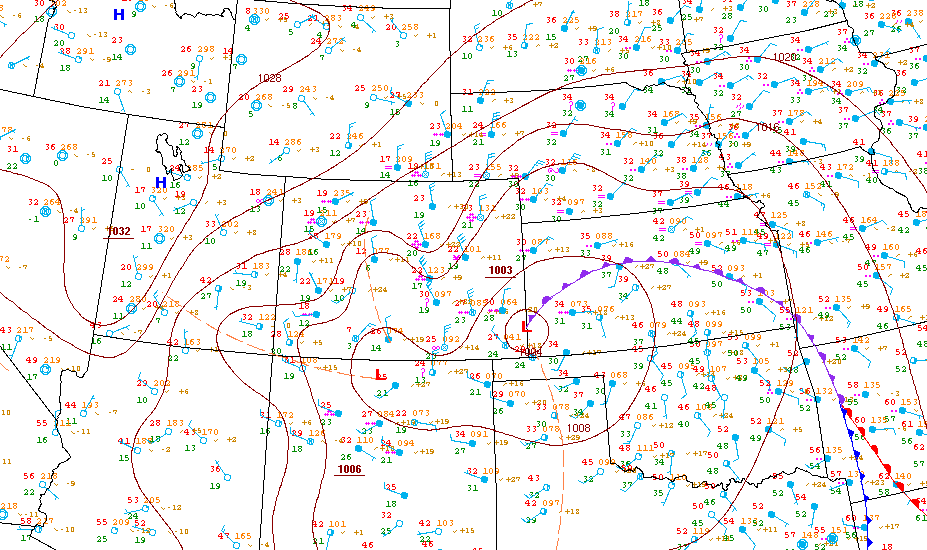
Surface weather chart for the Front Range area from 7:00PM MST on December 20th
Here
Surface weather chart from the NWS at 5:00PM MST (00z) on December 20th (21st)
Here
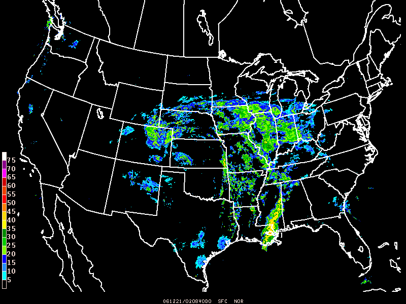
National Radar at 7:08PM MST (0208z) on December 20th
Here
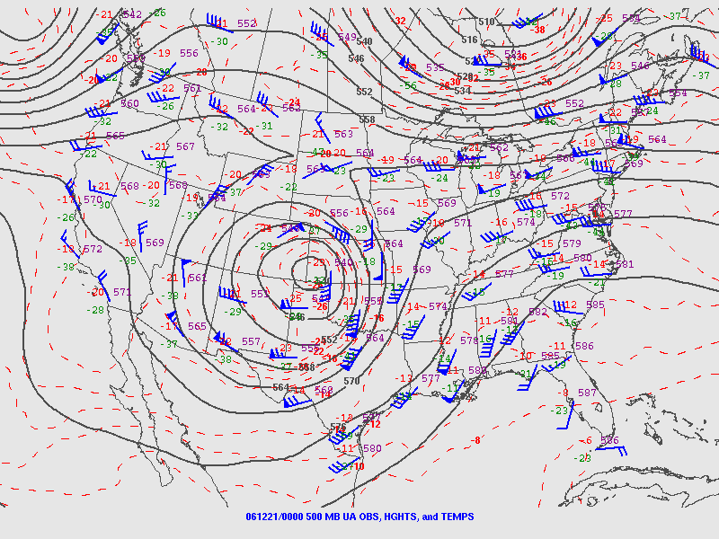
500mb chart 5:00PM MST (00z) on December 20th (21st)
Here
Radar
35-frame loop of radar from Cheyenne (CYS) that goes from 4:00AM December 20 to 2:00PM December 21, on the hour
37-frame loop of radar from Denver (FTG) that goes from 3:00AM December 20 to 3:00PM December 21, on the hour
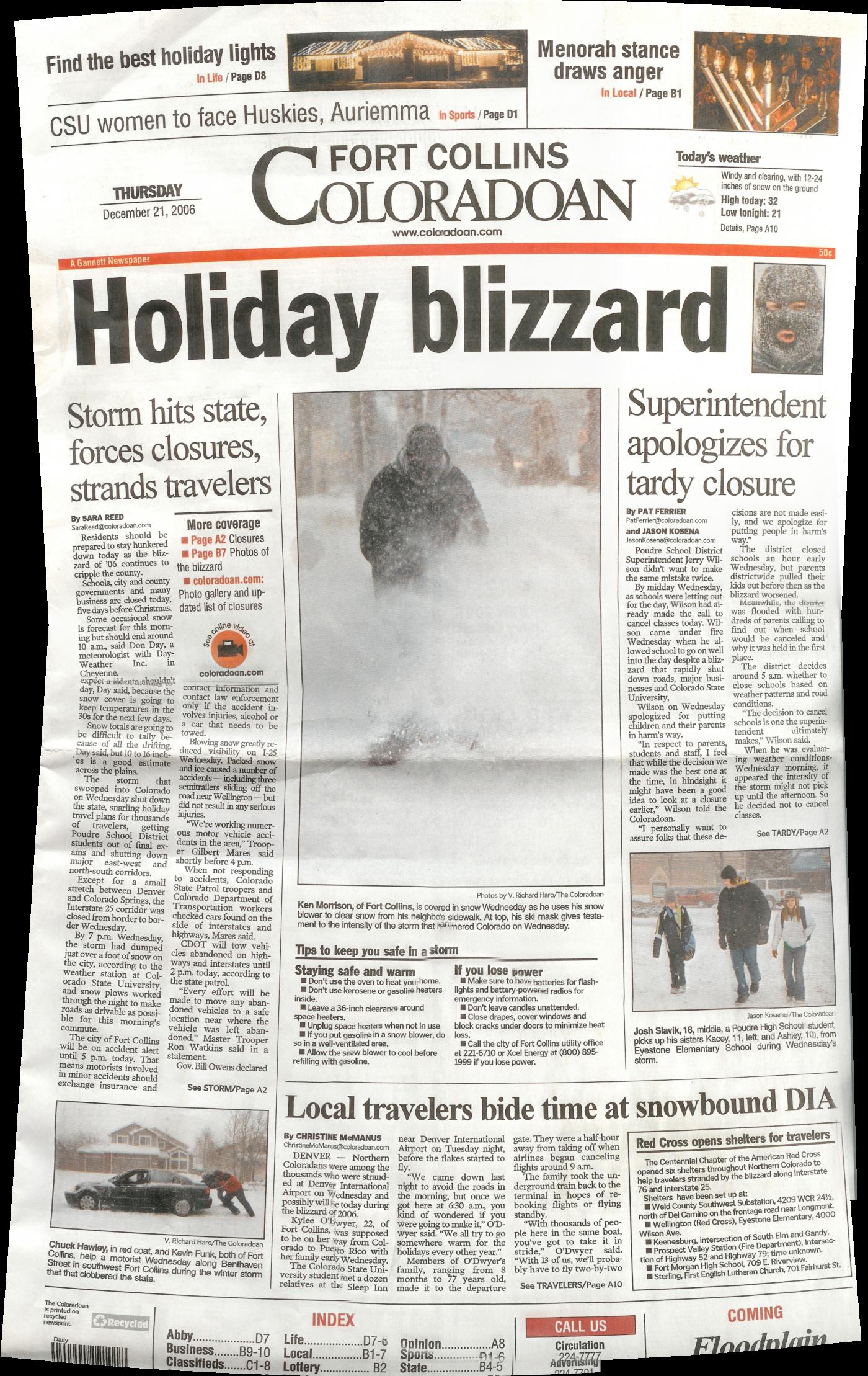
Fort Collins Coloradoan December 21 front page (580KB)
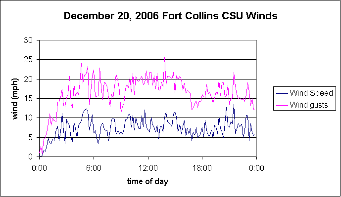
CSU Wind graph from December 20
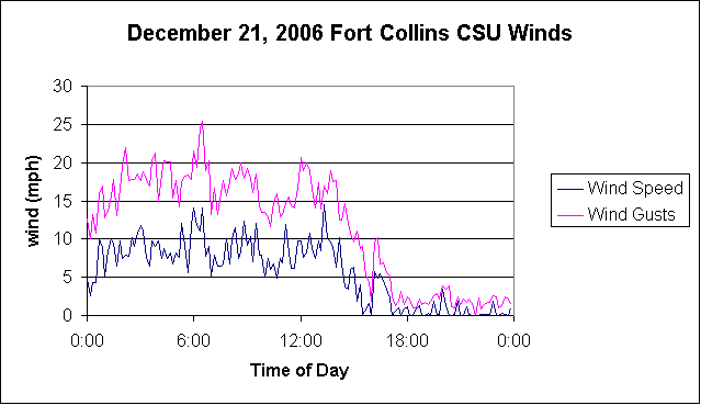
CSU Wind graph from December 21
Christman Field Wind graph from December 20
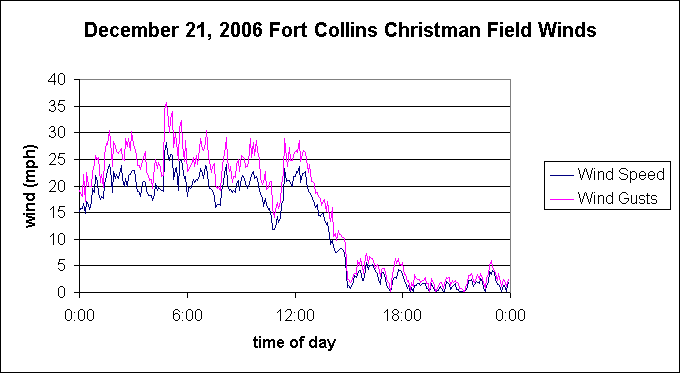
Christman Field Wind graph from December 21
Fort Collins-Loveland Airport METARs
Greeley-Weld County Airport METARs
Blizzard conditions: the wind gusts must be over 35 mph (or 31 knots) and the visibility (due to snow) must be really low
string of Fort Collins-Loveland Airport METARs with wind gusts over 30 knots
string of Greeley-Weld County Airport METARs with wind gusts over 30 knots
note: some of these observations have visibility measurements (many 1/4 mile visibility), some don't have anything for visibility. Possibly the visibility instrument broke or got clogged with snow.
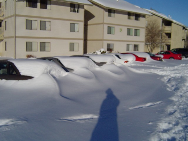
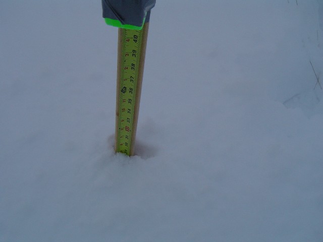
Pictures from December 21st:
measurement of a 29" snow drift where the snow was relatively flat.
The purpose is to provide high quality information on historical storms
and provide links to weather information.